FACULTY OF EXACT AND NATURAL SCIENCES
The Vakhushti Bagrationi Institute of Geography at TSU
Georgian geography grew out of the period of classical antiquity, and in the 18th century experienced a revival when works by Vakhushti Bagrationi, Description of the Kingdom of Georgia and the Geographical Atlas were published. Bagrationi was one of the most remarkable scientists of that period and his work has not lost its scientific and practical importance. His two principal publications have been listed inUNESCO’s Memory of the World Register. The Institute of Geography marked the 300th anniversary of Bagrationi’s birth in 1997 by re-publishing his atlas and organizing commemorative events. At the same time the Institute published a new Georgian Atlas.
HISTORY
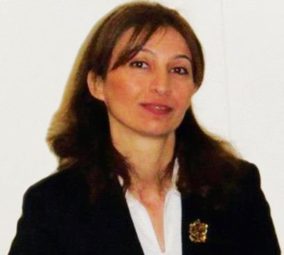
Dr. Nana Bolashvili, Director of the Institute of Geography, pointed out that the Vakhushti Bagrationi Institute was founded in 1933 within the Faculty of Geography of Tbilisi State University. Its founder and director for 29 years was Alexander Javakhishvili, the founder of geographical sciences and the Georgian School of Geography.
Other well-known scientists and academicians of the Georgian Academy of Sciences worked at the Institute at various times: Alexander Javakhishvili, Teopane Davitaia; corresponding members of the Academy Alexander Aslanikashvili, Vakhtang Jaoshvili, Zurab Tatashidze, Archil Kiknadze; and Professors Giorgi Gechtman, Luarsab Karbelashvili, Levan Maruashvili, Davit Tsereteli, Mitropane Kordzakhia, Davit Ukleba and Givi Gigineishvili.
In its first year the Institute published 13 works with 50 various thematic maps. The Georgian Academy of Sciences was created in 1941, while the Institute joined it in 1945, and in that same year was re-named after the Georgian scientist, Vakhushti Bagrationi. When the Institute was founded, it focused primarily on physical-geographical and economic-geographical research on separate administrative Georgian districts, and created relevant maps. Key features of the Georgian climate (air temperature regime, atmospheric precipitation) were studied. In the 1960s, the Institute was led by a famous climatologist, Academician Teopane Davitaia when it played an active role in the development of Soviet geographical science. The Institute returned to TSU in 2010.
PRIORITIES
Remote sensing of air pollution developed by the Institute was used in research on cosmic space. A natural process modeling laboratory was set up to carry out research on both land and ocean atmospheres, and the Batumi laboratory station was created by the Institute to contribute to this research. Other issues included applied climatology and biometeorology, the origin and transfer of heat in the human body and the influence of meteorological elements on the human body.
For several years Teopane Davitaia worked at the Cuban Academy of Sciences and led a large group of scientific consultants-- including researchers from the Institute of Geography. This group accomplished the important task of creating the National Atlas of Cuba in 1940. A map of agro-climatic resources of the former Soviet Union was printed in 1973 which defined the potential of further agricultural development on the entire territory of the former Soviet Union. The creation of the Institute of Geography laid the foundation for hydrological research as well. The genetic classification of rivers in Georgia was carried out with a description of coastal rivers, lakes and estuaries of the Black Sea and the Sea of Azov. A Caucasus streamflow map was created in 1964 for a physical-geographical atlas. In the late 1980s the Department of Hydrology began research on Caucasian water resources and water balance.
The Institute has continued to conduct glaciological research since 1960. Many Caucasian glaciers have been studied and maps of Caucasian glacier flow have been included in the world atlas of snow and ice resources in 1960. From the 1970s the Institute focused on research about geographic patterns of mountainous regions. A seacoast research laboratory was created in 1972 and from 1974-1980 it studied the key emergency areas of Georgia’s seacoast zone. New methods of coastal protection prevented a significant part of the Black Sea beaches from being washed away.
The establishment of the Karstology and Speleology Laboratory at the Institute of Geography in 1958 laid the foundation for systematic and regular research of karstic caves. This resulted in the registration of over 1300 underground monuments. Karstic caves were registered and researched by Sh. Kipiani, T. Kiknadze, and Z. Tatashidze and others.
In 1961 a significant discovery was made in the vicinity of New Athos (in Georgia’s breakaway region of Abkhazia) that triggered public interest all over the former Soviet Union. An empty area of 50,000m2 with total volume of 1.5 mln m3 was discovered underground. In the 1980s another important discovery was made in the Tskaltubo limestone massif. Today it is known that four of the world’s deepest karst caves are located in Georgia, the deepest of which has the world record of 2197m in depth, in Georgia’s (Abkhazia) karst area.
In 1982 the Institute’s staff participated in the creation of a new section of the Red Book of Georgia – Non-Organic Natural Monuments. Significant research was conducted in historical geography, especially the historical geographies of Kvemo Kartli and Shida Kartli as well as Kakheti. The Institute developed and scientifically justified a scheme of economic zoning for Georgia. Also in 1982, a two-volume edition entitled Key Issues of the Economic Geography of Georgia and a map of recreational zoning of the Georgian territory were also published.
TODAY
The civil conflicts of the 1990s significantly hampered the Institute’s scientific activity, and meant funding was scarce. Laboratories and thematic groups stopped functioning, while most employees left the Institute. This period was the most difficult of the Institute’s existence. In 2006, when the Institute separated from the system of the Academy of Sciences, it was initially granted the status of legal entity of public law and moved to the Ministry of Education and Science. Finally, in 2010, by a decree of the Georgian Government, it joined Tbilisi State University as an independent research institute.
In 2010 the Institute’s building was sold, as the outdated infrastructure--including the library and museum--were dilapidated, and significantly hampered scientific research. However, despite numerous difficulties, today the conditions in the Institute have changed for the better, due to increased financing (INTAS and Radford grants; as well as grants from the World Bank, Rustaveli National Science Foundation and the President’s fund for young researchers). Computers and GIS technologies have radically changed the type of the Institute’s activities.
Today the Institute is closely cooperating with ESRI, an international supplier of Geographic Information System (GIS) software, and their distributor DATA+. The Institute created the first 3-D digital map in Georgia (V. Geladze, A. Javakhishvili, D. Kartvelishvili). With financial support from the German Foreign Ministry, 3-D geographic digital maps of Georgia (1:500,000) and the Caucasus (1:800,000) have been created and printed. Some were given to the Ministry of Education and distributed free of charge to public schools. GIS principles of various scales and thematic maps were created and thematic maps were digitalized.
Over 150 monographs have been prepared and over 80 collections of works have been published at the Institute during its existence and it holds regular international conferences.
THE FUTURE
The Institute focuses primarily on creating geographic maps and atlases and presently is creating a Georgian educational geographical atlas. Speleological and glaciological research studies have been retained as priority directions. Next year, an international speleological expedition is being planned in collaboration with Lithuanian speleologists on the Samegrelo and Racha limestone massifs. Another project has been prepared jointly with Italian researchers to assess the anthropogenic impact in Tskaltubo cave.
Glaciers are the most remarkable indicators for the assessment of global warming and therefore field and laboratory studies will continue to monitor Georgia’s snow and glaciers. A project has been submitted to the Rustaveli National Science Foundation and talks are underway with Dr. Margit Schwikowski (Paul Scherrer Institute, Switzerland) to implement an international project to study Georgia’s air temperature and atmospheric precipitation through analyzing ice core.
Other projects: Research will continue to study mudslide processes; work is also underway to create an information system of Georgian water resources. Research is planned on morphological and metadynamic processes of the Black Sea coastal line. Research will continue to ascertain natural and anthropogenic transformation and dynamics of landscapes in different regions of the country and in various natural-landscape zones.
A monograph on Tourism Geography is planned, and the Institute of Geography has submitted approximately ten projects to the Rustaveli National Science Foundation for future funding.


